Getting lost in the wilderness is a real fear. The thrill of exploring vast landscapes can quickly turn into panic when you can’t find your way. I know that feeling.
This article aims to teach you how to get through in the wild by using distant features. When your immediate surroundings seem confusing, knowing how to look far can keep you on track.
I’ve drawn from countless expeditions and long-distance treks to give you practical advice that works. You’ll learn strategies that combine time-tested wisdom with modern techniques.
The core problem we all face is disorientation when landmarks are not visible. This guide offers a solution for remote wilderness navigation. You’ll discover how to use the horizon and distant points to orient yourself, even when everything around you feels unclear.
Mastering these skills will transform your outdoor adventures. Imagine feeling confident and safe, knowing you can find your way no matter where you roam. Let’s dive into the world of navigation from a distance and make your journeys more exciting and secure.
The Power of Distant Landmarks: Your Horizon Guides
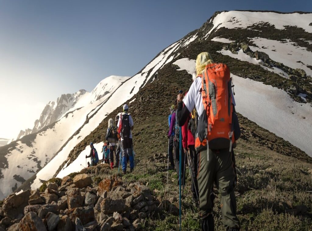
In the wild, distant landmarks are your best friends. We’re talking about those prominent mountain peaks or unique rock formations. They’re not just pretty sights.
They’re key for remote wilderness navigation. Why? Because these long-range features offer constant reference points that keep you on track over miles.
When you’re out there, you’re not fumbling through the brush with your nose to a map every few minutes. Instead, you’re glancing up at a massive peak, feeling like Indiana Jones (minus the fedora).
So, how do you actually choose and use these landmarks? First, scan the horizon. Spot something big and unmistakable.
Use binoculars if you’re squinting more than seeing. Then, compare this sight to your map. You’d be amazed how a single distant peak can anchor your entire journey, letting you track progress without a compass glued to your hand.
Pro tip: Don’t pick a landmark that disappears behind every hill. Go for something towering and visible for miles. (Think of it like picking a reliable co-star in your adventure movie.) Choose wisely and these distant friends will guide you safely, ensuring you always have a sense of direction.
Mapping Your Wilderness Path: Mastering the Terrain
Picking the right map is like finding the right song for a road trip. It sets the tone. For remote wilderness navigation, topographic maps are your best friend.
They show the lay of the land (literally). Get one with the right scale for your journey. Don’t skimp on this.
Now, how do you orient it? Use a compass and find a distant natural feature. Line it up with the map.
Easy, right? Not always. But with practice, you’ll get there.
Peaks, valleys, and ridgelines aren’t just pretty (they’re) your landmarks. Spot them on your map and match them to the horizon.
Plotting a route is like painting a picture in your mind. Use those distant waypoints to sketch your path. It’s not just about going from point A to B.
You have to visualize the terrain in between. Anticipate challenges and plan your moves.
A pro tip? Always keep an eye on key features. They’re like breadcrumbs leading you home.
And if you’re dreaming big, why not start creating your personal adventure itinerary? Trust me, the right prep makes all the difference in the wild.
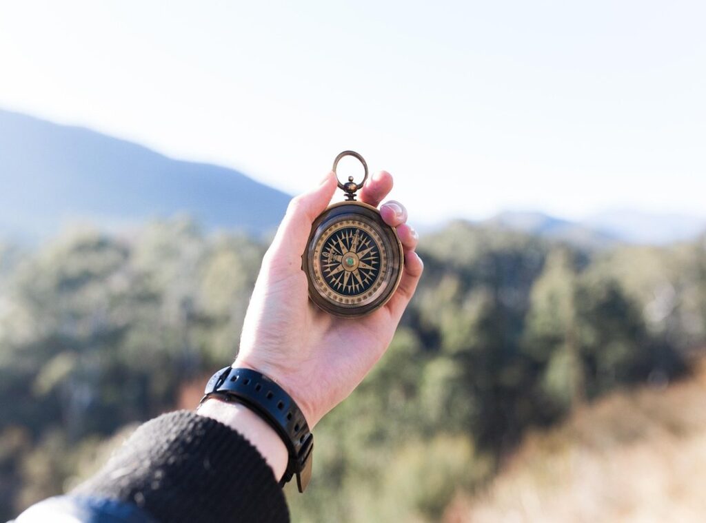
Compass and Bearing: Navigating the Wilderness
Ever feel lost, even with a fancy GPS? Let’s get back to basics with a trusty compass. Knowing your compass parts is key.
The baseplate, magnetic needle, and the housing each play their part. But first, hold it flat in your palm. No tilting allowed.
Ready to take a bearing? Aim your compass at that far-off tree (or a mountain if you’re feeling dramatic). Spin the compass dial until the needle lines up with the orienting arrow.
Now read the degrees. Simple, right? Here’s a pro tip: always double-check with a back bearing.
It’s like having a backup plan. Aim back to where you started to confirm your direction.
Setting a course is next. Find a landmark, set your compass, and head straight. But what if the terrain’s rough?
Pick a closer spot aligned with your target. That way, you won’t veer off course.
In remote wilderness navigation, this skill is gold. Imagine you’re in a thriller movie (cue dramatic music), and you’re the hero finding your way out. Pretty cool, huh?
You just need that compass and a bit of confidence.
Natural Clues: The Wilderness Speaks
You ever feel lost in the middle of nowhere and think, “What now?” It’s wild how nature can help. For starters, the sun’s got your back. Use the shadow tip method.

Put a stick in the ground, mark the tip of the shadow, wait a bit, and mark it again. Boom, you’ve got an east-west line. Simple, right?
Stars can guide you too. Polaris, the North Star, is your friend in the Northern Hemisphere. It’s like nature’s own GPS.
And clouds? They aren’t just pretty to look at. They can hint at weather changes.
Big, puffy ones might mean a storm’s brewing.
Trees aren’t just there for shade. They can point you in the right direction. Usually, you’ll find more growth on the side facing the sun.
Just don’t bet your life on it. And animals? They know where water is (usually they know best), so follow those trails.
But let’s not forget, nature’s a big puzzle. It’s about the big picture. Keen observation is key.
For more on this, check out remote wilderness navigation. It’ll help you piece it all together.
Navigating the Great Unknown: Tech Meets Tradition
Modern tech has transformed remote wilderness navigation. I rely on GPS devices and satellite communicators. They’re backups, not the main event.
Using GPS to confirm your position relative to distant landmarks is a game-changer. You can track your progress, mark key waypoints, and feel a bit like a sci-fi hero (at least I do). But tech isn’t foolproof.
Think of them as a safety net. Traditional skills are non-negotiable.
Batteries die. Signals disappear. Devices fail.
Satellite imagery and mapping apps are fantastic for pre-trip planning. They’re like having x-ray vision for the space. You can identify and study distant features before you even set foot in the wilderness.
But don’t forget those traditional skills. They’re your best friend when tech lets you down.
Pro tip: Always download maps offline. Trust me, it’s a lifesaver when your signal’s gone AWOL.
For more on these Important Skills Safe Mountain Hiking, check out the resources available. It’s about finding that balance between using technology and honing your natural navigation instincts.
Venture Beyond Familiar Trails
Mastering remote wilderness navigation gives you the power to explore without fear. I know the anxiety of feeling lost in the wild. It can be paralyzing.
But with the right skills, you can tackle any terrain confidently.
Learning to read maps, use a compass, and observe nature gets easier when you practice. Start in familiar places. Build your muscle memory before hitting those grand adventures.
You don’t have to feel lost. You can conquer the wilderness. So, pack your gear and sharpen your skills.
Let the distant horizon guide your next unforgettable journey.
Take the leap. Embrace the adventure. The wild is waiting.